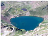
| Quick Facts: | Great Slave Lake |
|---|---|
| Country: | Canada |
| Frozen: | November to mid. of June |
| Catchment area: | 971.000 km² (374.905 mi²) |
| Surface Area: | 27.200 km² (10.502 mi²) |
| Max. Lengh: | 480 km (300 mi) |
| Max. Width: | 109 km (68 mi) |
| Avg. Depth: | 41 m (135 ft) |
| Max. Depth: | 614 m (2.014 ft) |
| Water volume: | 1.580 km³ (380 mi ³) |
| Surface elevation: | 156 m (512 ft) |
| Primary inflows: | Hay River Slave River |
| Primary outflows: | Mackenzie River |
| Lake Type: | remnant of a glacial lake |
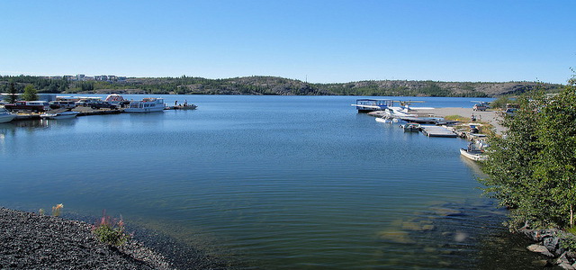
Located in north-central Canada, Great Slave Lake is the fifth-largest lake in North America, with an area of about 11,000 square miles (28,490 sq km). It is situated in the Fort Smith region of the Northwest Territories.
Its shape is irregular; its maximum length is about 300 miles (480 km) and its maximum width about 70 miles (112 km). Woods line the western shore; to the north and east lie tundra. The Mackenzie, the major river of northwestern Canada, issues from the lake’s western end. Several rivers enter the lake, of which the Slave River, on the south, is the largest.
Economic Importance:
Lead, zinc, and gold are mined in the region. The fisheries in the lake have become most important since World War II. The Mackenzie Highway from Hay River on the south shore provides year-round transportation to the south. The town of Yellowknife (population: 17,275), on the northeast shore, is the seat of government for the Northwest Territories