| Quick Facts: | Lake Bonneville |
|---|---|
| Countries: | USA |
| Formed: | 32.000 years ago |
| disappeared: | 14.500 years ago |
| Estimated Area: | 50.000 km² (120.000 mi²) |
| Max. Depth: | 1.000 ft (300 m) |
| Type: | Pluvial Lake |
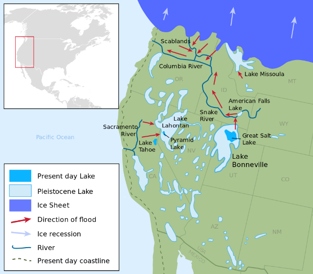
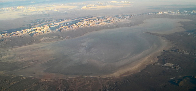
Lake Bonneville is the name of a prehistoric lake that extended over most of northwestern Utah in the late Pleistocene epoch, approximately 17,000 to 9,000 years ago. The waters of the ancient lake have contracted to the area of the present Great Salt Lake.
At its greatest extent, Lake Bonneville had an area of 20,000 square miles (50,000 sq km) and a volume more than 500 times as great as the Great Salt Lake, which has an area of 1,650 square miles (4,250 sq km). Its water was fresh, as compared with the 23% salt content accumulated in the present lake. Lake Bonneville drained northeast into the valley of the Snake River.
Terraces left by the ancient lake can be observed at levels about 50, 300, and 650 feet (15, 90, and 190 meters) above the present water level. The terraces are not quite horizontal; the deviations have been caused by subsequent warping and other geological factors.
From the study of radioactive carbon isotopes in shells found on the terraces, it has been determined that there were four stages of higher water level. The stages occurred about 17,000, 14,500, 12,000, and 9,500 years ago, during the waning of the great ice sheets of the Pleistocene epoch. There were intervening stages of lower water level. These varying levels were dependent upon the balance between water inflow and the evaporation rate in the region; the higher levels existed during the more humid periods.