| Quick Facts: | Lake Huron |
|---|---|
| Countries: | USA & Canada |
| Group: | Great Lakes |
| Type: | Glacial |
| Catchment area: | 51.700 sq mi (134.100 km²) |
| Surface elevation: | 577 ft (176 m) |
| Max. length: | 206 mi (332 km) |
| Max. width: | 183 mi (295 km) |
| Surface Area: | 23.000 sq mi (59.600 km2) |
| Average depth: | 195 ft (59 m) |
| Max. depth: | 750 ft (229 m) |
| Water volume: | 850 cu mi (3.543 km3) |
| Primary outflows: | St. Clair River |
| Primary inflows: | Straits of Mackinac & St. Marys River |
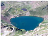
Lake Huron is the central lake of the Great Lakes in North America, lying between the province of Ontario, Canada, and the state of Michigan. Lake Huron has the longest shoreline of any of the Great Lakes, is second only to Lake Superior in drainage basin area, and has the third-largest water volume. Its water surface area is 23,010 square miles (59,600 sq km); its length, 206 miles (330 km); and its breadth, 183 miles (295 km). Lake Huron’s average depth is 195 feet (60 meters). It connects with Lake Superior via the St. Mary’s River; with Lake Michigan through the Straits of Mackinac; and with Lake Erie via the St. Clair River–Lake St. Clair–Detroit River system.
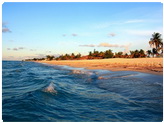
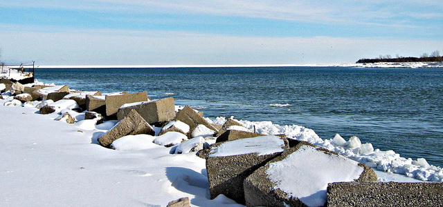
Lake Huron is noted for the natural beauty of its shores and the fine quality of its water. The gradual slope of its shoreline, sand and gravel beaches, bluffs and rock outcrops make thelake area desirable for shore-based living and recreation. Huron is said to have more islands than any other lake in the world. Canada’s Manitoulin Island, flanking beautiful Georgian Bay, is probably the world’s largest island in fresh water. Most of Mackinac Island at the entrance to the straits, once a fur-trading center, is now a state park. Winter sports—skiing, skating, and snowmobiling—are becoming increasingly popular in the Lake Huron area.
Economy Importance of Lake Huron
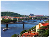
Manufacturing contributes 80% of the income in the Lake Huron area; mining, agriculture, forestry, fishing, and recreation make up the remaining 20%. Two million people live in the region. There are seven deepwater U.S. ports and four Canadian ports. The cities of Flint, Midland, Bay City, and Saginaw, Michigan, and Sarnia, Ontario, are important industrial centers.
The east bank of the St. Clair River is known as Canada’s “Chemical Valley” because of its oil refineries and petrochemical plants. Completion of the St. Lawrence Seaway in 1958 gave ports on Lake Huron and other Great Lakes access to the Atlantic Ocean. Oceangoing vessels transport general cargoes and some bulk cargoes—principally grain—to all parts of the world. Within the Great Lakes, large vessels called “lakers” carry chiefly iron ore, grain, stone, and coal; tankers move petroleum products.
Natural Resources
Minerals found in the Lake Huron Basin include uranium, gold, silver, copper, salt, limestone, sand, gravel, and clay. More than 93% of the land in the basin is classified for “rural use,” permitting extensive development of agriculture and forestry. There are huge stands of new-growth spruce, fir, pine, oak, hickory, birch, beech, maple, and hemlock. Agricultural enterprises include dairying and the raising of livestock, sugar beets, beans, and potatoes. The pasturelands and farms provide natural habitats for songbirds, upland game birds, deer, elk, and black bear.
The fish population has suffered for many years from sea lampreys and alewives, but controls on these pests have been instituted. Much of the commercial fishing in the Lake Huron area is done in Saginaw Bay. The catch there approximates 3 million pounds (1.3 million kg) a year, which is 25% of the total commercial catch in Lake Huron. Fish include walleyed pike, yellow perch, bluegills, northern pike, trout, bass, muskellunge, and pickerel.
Lake Huron History
Étienne Brulé, a young Frenchman brought to North America by Samuel de Champlain, visited Georgian Bay with some Indians before 1615. He thus became the first European to see any of the Great Lakes. Huron has been noted for its furious storms. A storm in November 1913 caused the loss of 17 ships and 285 lives.