| Quick Facts: | Lake Kivu |
|---|---|
| Countries: | Democratic Republic of the Congo Rwanda |
| Lake Type: | Rift Valley lakes & Meromictic |
| Catchment Area: | 2.700 km2 (1.000 sq mi) |
| Max. Length: | 89 km (55 mi) |
| Max. Width: | 48 km (30 mi) |
| Surface Area: | 2.700 km2 (1.040 sq mi) |
| Avg. Depth: | 240 m (787 ft) |
| Max. Depth: | 480 m (1.575 ft) |
| Water volum: | 500 km3 (120 cu mi) |
| Surface elevation: | 1.460 m (4.790 ft) |
| Primary inflows: | Nicollet Creek & Elk Lake outlet stream |
| Primary outflows: | Ruzizi River |
| Islands: | Idjwi |
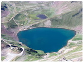
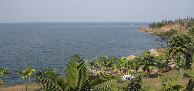
Located in the Great Rift Valley of eastern Africa, between the Democratic Republic of the Congo and Rwanda, Lake Kivu is one of the Africa’s Great Lakes. The main settlements lying on the Lake Kivu are Goma and Bukavu in Congo, Kibuye and Cyangugu in Rwanda.
About 55 miles (90 km) long and 30 miles (50 km) wide, Lake Kivu has an area of 1,040 square miles (2,700 sq km). Its surface is 4,790 feet (1,460 meters) above sea level, and its waters reach a depth of 1,558 feet (475 meters). The lakedrains southward through the Ruzizi River into Lake Tanganyika.
Lake Kivu Tourism
Noted for its beauty, Lake Kivu is surrounded by lofty mountains and contains many islands, the largest of which is Idjwi, in Congo. The shores are densely populated, from Bukavu (Congo) in the south to Goma (Congo) and Gisenyi (Rwanda) in the north. Mururu Dam, at the outlet of the Ruzizi, supplies power to both Congo and Rwanda. A potential source of energy is natural gas, reserves of which, in the deep waters of the lake, are among the largest in the world.