| Quick Facts: | Lake Peipus |
|---|---|
| Countries: | Estonia Russia Latvia Belarus |
| Lake Type: | Glacial origin |
| Frozen: | December to March |
| Catchment area: | 47.800 km2 (18.500 sq mi) |
| Surface Area: | 3.555 km2 (1.373 sq mi) |
| Shore Lengh: | 520 km (320 mi) |
| Avg. Depth: | 7.1 m (23 ft) |
| Max. Depth: | 15.3 m (50 ft) |
| Water volum: | 25 km3 (6.0 cu mi) |
| Surface elevation: | 30 m (98 ft) |
| Primary inflows: | Emajõgi Velikaya |
| Primary outflows: | Narva |
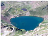
Lake Peipus is one of the largest lakes in Europe. It forms part of the border between the Russian and Estonia. Called Chudskoye Ozero in Russian and Peipsi Järv in Estonian, it is connected at its southern end by a 15-mile (24-km) strait to Lake Pskov. Peipus is fed from the west by the Emaiygi River and from the south, through Lake Pskov, by the Velikaya River. It empties into the Gulf of Finland by way of the Narva River.
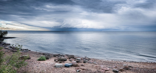
Of glacial origin, the lake is bordered by woods, marshes, and sand dunes. Its area, combined with that of Lake Pskov, which is often considered part of it, is about 1,400 square miles (3,600 sq km). Exclusive of Lake Pskov, it is about 60 miles (97 km) long and up to 31 miles (50 km) wide. It reaches a depth of 50 feet (15 meters). The lake, which contains several islands, is frozen from December to March. It is fished, particularly for smelts.
The frozen strait between Peipus and Pskov was the scene in 1242 of Alexander Nevsky’s victory over the Teutonic Knights.