| Quick Facts: | Maracaibo Lake |
|---|---|
| Countries: | Venezuela |
| Type: | Coastal saltwater bay |
| Surface area: | 13.210 km2 (5.100 sq mi) |
| Max. length: | 99 miles (159 km) |
| Max. width: | 67 miles (108 km) |
| Max. depth: | 60 m (200 ft) |
| Primary outflows: | Gulf of Venezuela |
| Primary inflows: | Catatumbo River |
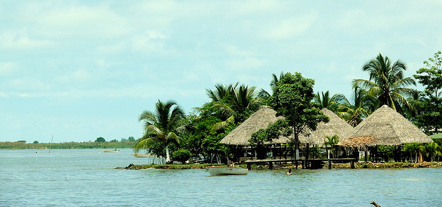
Maracaibo Lake (Lago de Maracaibo) is a body of water in northwestern Venezuela and the center of the country’s oil production. The lake, which occupies the bottom of the Maracaibo Lowlands, is 75 miles (120 km) wide and extends 130 miles (210 km) inland, including the channel that connects it with the Gulf of Venezuela (Caribbean Sea).
A sandbar obstructing the channel entrance has been dredged to permit the passage of ocean-going vessels to the southern end of the lake. Maracaibo, the chief port, is situated on the western side of the narrows, which are spanned by a bridge 5 miles (8 km) long.
The water is fresh at the southern end of the lake but becomes brackish toward the north. An oil field extends under and along the northeastern part, and there are other fields to the northwest. Together these fields produce more than 70% of Venezuela’s oil, making the country a leading exporter of energy.


